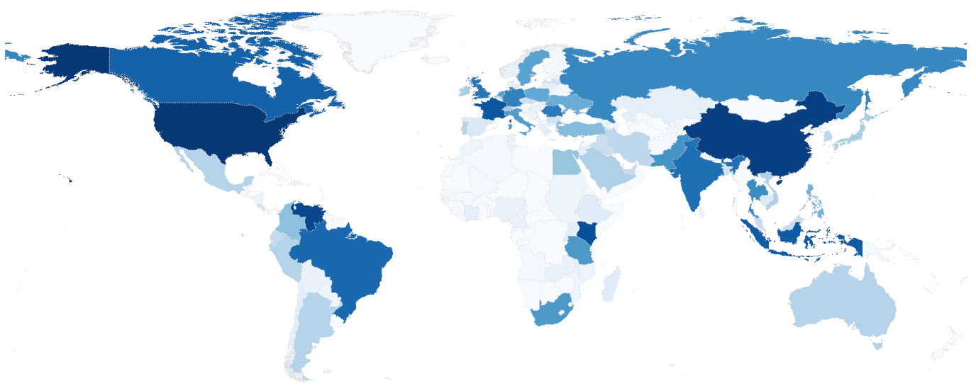
The Landscapes Portal is growing rapidly. Into our fourth month, the Landscapes Portal has around five hundred unique data sets with complete meta-data and more than two hundred registered users that are uploading and sharing spatial data and maps. We saw a lot of interest in the last two months with more than four thousand ...
Category archives: New maps
Blog posts highlighting new maps posted to the landscapes portal.
Usage statistics for the Landscapes Portal
Written by on June 4, 2014 in GIS, New maps.
Last update on June 26, 2014.
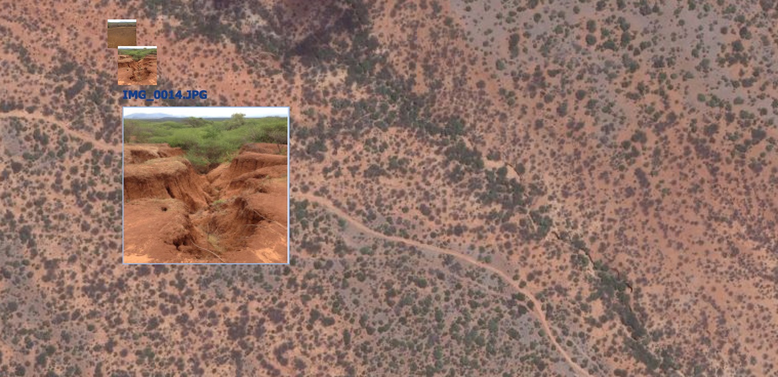
Adding geotagged photos to your map can be a powerful way to visualize the landscape that you are mapping, or even as a way to validate your mapping outputs. In the Landscapes Portal you can do this in three simple steps when creating a new map or when editing one of the existing maps on ...
Want to know what we are up to?
Written by on April 2, 2014 in Software, New maps.
Last update on April 2, 2014.
In the GeoScience Lab we are constantly pushing the envelope on what we do with models and maps. This presentation gives you an idea of what we are up to at the moment:
Maps of soil functional properties for Africa
Written by on Jan. 16, 2014 in Land Degradation, New maps, Soil Mapping.
Last update on March 19, 2014.
The Land Degradation Surveillance Framework (LDSF) was developed at the World Agroforestry Centre for landscape level assessments and studies of carbon dynamics, vegetation changes, soil functional properties and soil hydrological properties. The LDSF has been implemented in more than 20 countries in Africa to date, including the CIAT-led [Africa Soil Information Service (AfSIS)]("http://worldagroforestry ...