Category archives: Land Degradation

Farmer-managed natural regeneration as a land restoration strategy. Under what conditions does it work?

Last update on Sept. 17, 2020.

Farmer-managed natural regeneration as a land restoration strategy. Under what conditions does it work?

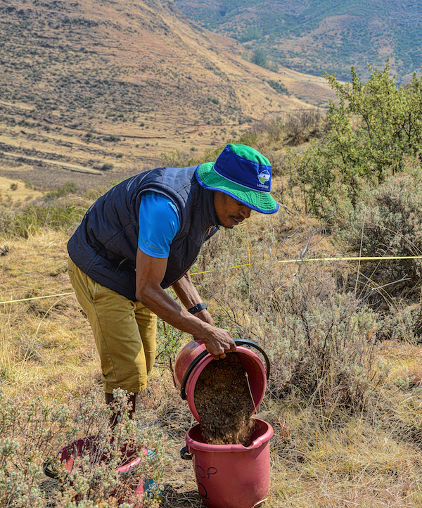
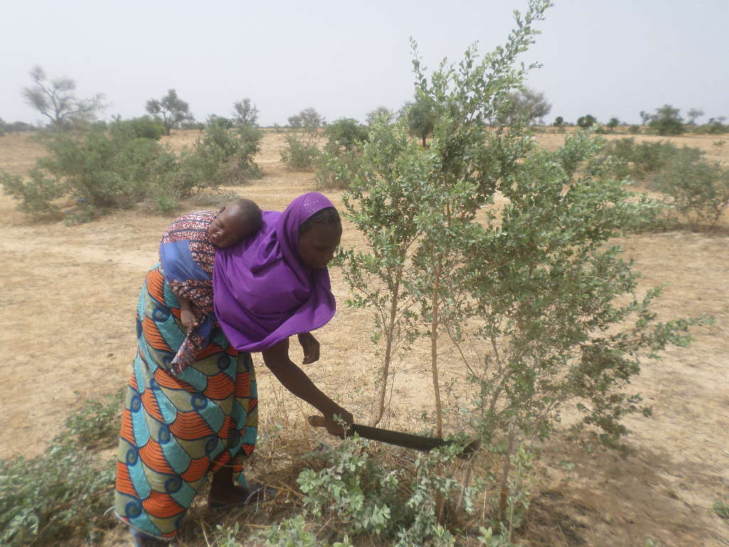
Photo: Farmer removing side stems from naturally regenerated Guiera senegalensis to enhance its growth, a key FMNR practice (by P. Savadogo/ ICRAF).


This blog is reposted with permission from the ICRAF website


Farmer-managed natural regeneration as a land restoration strategy. Under what conditions does it work?


The upcoming UN decade on Ecosystem Restoration aims to ...

Continue reading

Finding evidence for land-restoration strategies

Last update on Jan. 15, 2018.

Finding evidence for land-restoration strategies

Photo of an agricultural landscape in Eastern Uganda, by Madelon Lohbeck


Restoration has never been more important, with almost a third of the world’s land surface degraded. But what exactly is restoration? And how do we know if it works?


More than 1.5 billion of the world’s poorest people are directly affected ...

Continue reading

Working with nature: tropical forest regrowth and its potential for mitigating climate change

Last update on March 30, 2017.

Working with nature: tropical
forest regrowth and its potential for mitigating climate change

The Bonn challenge aims to restore 350 million hectares of
degraded land by 2030 of which currently almost 100 million hectares has been
committed through various initiatives. Restoration is a global priority; not
only to restore the productivity of degraded and unproductive ...

Continue reading

Restoring land for and with Kenyan pastoralists

Last update on July 24, 2015.

Restoring land for and with Kenyan pastoralists

Read the ICRAF blog here:
http://blog.worldagroforestry.org/index.php/2015/07/08/restoring-land-for-kenyan-pastoralists/

The Land Degradation Surveillance Framework (LDSF)

Last update on March 27, 2015.

The Land Degradation Surveillance Framework (LDSF)


Key facts ...

Continue reading

Field sampling on Mt Elgon, Uganda

Last update on March 6, 2015.

Field sampling on Mt Elgon, Uganda

The field team from the ICRAF GeoScience Lab led by John Maina and Clement Okia (ICRAF Uganda) has completed the first of two Land Degradation Surveillance Framework (LDSF) sites on Mt Elgon in Uganda, as part of the project "Filling knowledge gaps on the restoration of degraded smallholder landscape mosaics". See slides below to get ...

Continue reading

Explore data from our network of LDSF sites in the Sentinel Landscapes

Last update on Aug. 5, 2014.

Explore data from our network of LDSF sites in the Sentinel Landscapes

We are in the process of developing an interactive online mapping and analytical platform, and have just released a test version for the Sentinel Landscapes initiative. Click here to run the application in a new window in your browser. You can also view the sites on the Landscapes Portal here.

Mapping the source of soil erosion

Last update on May 21, 2014.

Mapping the source of soil erosion

Predicting soil erosion

Conventional soil erosion models are generally based on the Universal Soil Loss Equation (USLE), or a revised (RUSLE) or modified (Williams and Berndt (1977)) version of the USLE. Betrie et al (2011) used the Soil and Water Assessment Tool (SWAT), which uses MUSLE to compute soil erosion, to model sediment transport in ...

Continue reading

Land cover change in the Virunga landscape

Last update on Feb. 24, 2014.

The Virunga landscape has one of the greatest diversities of habitats globally within about 790 thousand hectares. Thousands of hippopotamuses and elephants live in the park's rivers and its mountains are a critical area for the survival of the mountain and lowland gorillas. However, these habitats have undergone dramatic changes in land cover and ...

Continue reading

Maps of soil functional properties for Africa

Last update on March 19, 2014.

The Land Degradation Surveillance Framework (LDSF) was developed at the World Agroforestry Centre for landscape level assessments and studies of carbon dynamics, vegetation changes, soil functional properties and soil hydrological properties. The LDSF has been implemented in more than 20 countries in Africa to date, including the CIAT-led [Africa Soil Information Service (AfSIS)]("http://worldagroforestry ...

Continue reading