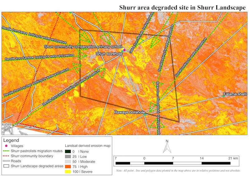
A community best understands its resources, the specific locations and seasonal variations of grazing resources. It is with this knowledge that the GeoScience Lab in collaboration with International Union for Conservation of Nature (IUCN), planned and executed a community-based resource mapping exercise for Hurri hills and Shurr landscapes in Marsabit County. Historically, both landscapes were reserve-grazing areas, only used during the wet season for water and/or pasture. Presently, however, the two areas have permanent settlements and in cases when the settlers have to move with their cattle in search of pasture and water, the young men go with the cattle leaving behind the rest of their families. This new trend of having not only permanent settlers graze in these areas but also majority of the neighboring pastoral communities move in and out at will has led to overgrazing, land degradation and resource depletion in these landscapes.
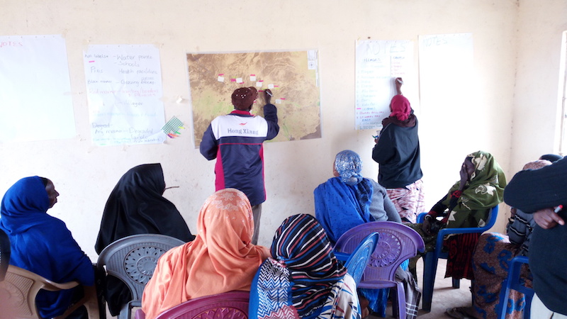
The ICRAF GeoScience Lab generated a number of maps for the landscapes, including maps of land degradation (soil erosion) and vegetation cover. These maps were used in interactive exercises with communities in each landscape, with a group of 40 community members in each. Three groups were formed - i.e. women, elders and young men and participants provided their own interpretations of the evidence shown in the maps. In addition they were asked about seasonal migration patterns, which were then added to the maps. The information gathered was taken to a workshop in Marsabit, where the results were presented and used as part of the Stakeholder Approach to Risk Informed and Evidence Based Decision Making (SHARED) methodology, which was developed by ICRAF.
Comments
No comments yet.