In the GeoScience Lab we are constantly pushing the envelope on what we do with models and maps. This presentation gives you an idea of what we are up to at the moment:
Author archives: Tor-G. Vagen
Want to know what we are up to?
Written by on April 2, 2014 in Software, New maps.
Last update on April 2, 2014.
Mapping soil functional properties using multilevel models
Written by on March 13, 2014 in R, Soil Mapping.
Last update on March 13, 2014.
>*Tor-Gunnar Vågen (ICRAF), Leigh Winowiecki (CIAT), Lulseged T. Desta (CIAT) and Jerome E. Tondoh (CIAT)*
In this document we present examples of R functions and scripts that may be used to generate local maps of soil functional properties based on for example remote sensing data, climate surfaces and/or digital elevation models and their derivatives ...
The Western Ghats sentinel landscape
Written by on Feb. 25, 2014 in Biodiversity, Deforestation.
Last update on Feb. 25, 2014.
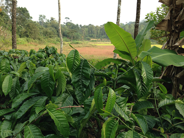
**Forest and Agroforest Mosaics of the Western Ghats**
Agroforesty systems (coffee, tea, rubber, pepper, arecanut, cardamom) shape much of the landscape of the Western Ghats, India, and the mountain range has been identified as a biodiversity hotspot (Conservation International 2008; Myers et al. 2000). Before the development of large scale commercial cultivation under British colonial ...
Land cover change in the Virunga landscape
Written by on Feb. 10, 2014 in Biodiversity, Land Degradation, Deforestation.
Last update on Feb. 24, 2014.
The Virunga landscape has one of the greatest diversities of habitats globally within about 790 thousand hectares. Thousands of hippopotamuses and elephants live in the park's rivers and its mountains are a critical area for the survival of the mountain and lowland gorillas. However, these habitats have undergone dramatic changes in land cover and ...
Maps of soil functional properties for Africa
Written by on Jan. 16, 2014 in Land Degradation, New maps, Soil Mapping.
Last update on March 19, 2014.
The Land Degradation Surveillance Framework (LDSF) was developed at the World Agroforestry Centre for landscape level assessments and studies of carbon dynamics, vegetation changes, soil functional properties and soil hydrological properties. The LDSF has been implemented in more than 20 countries in Africa to date, including the CIAT-led [Africa Soil Information Service (AfSIS)]("http://worldagroforestry ...