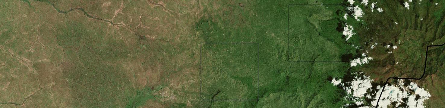
The field team from the ICRAF GeoScience Lab led by John Maina and Clement Okia (ICRAF Uganda) has completed the first of two Land Degradation Surveillance Framework (LDSF) sites on Mt Elgon in Uganda, as part of the project "Filling knowledge gaps on the restoration of degraded smallholder landscape mosaics". See slides below to get ...
Field sampling on Mt Elgon, Uganda
Written by on March 6, 2015 in Biodiversity, Land Degradation, Deforestation, Soil Mapping.
Last update on March 6, 2015.
After a one-week break, our brown-bag seminar series resumed again. In seminar 5, Antony Ndungu presented a number of different R graphing functions. Complete source code for the 5th seminar is available below, while the data used in the exercises can be found here.
NB! From next week, we will looking at the wonderful ggplot2 ...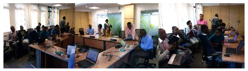
The third and fourth R brown-bag seminars were held on 12th and 19th of February, respectively. Both seminars covered "Introduction to R".
Complete source code for both seminars is available at this link, while the data used in the exercises can be found here.
In fifth seminar (5th of March), Anthony Ndungu (a.ndungu@cgiar ...
Aerial images from Kenya georeferenced by the ICRAF GeoScience Lab
Written by , on Feb. 11, 2015 in GIS, Software.
Last update on Feb. 11, 2015.
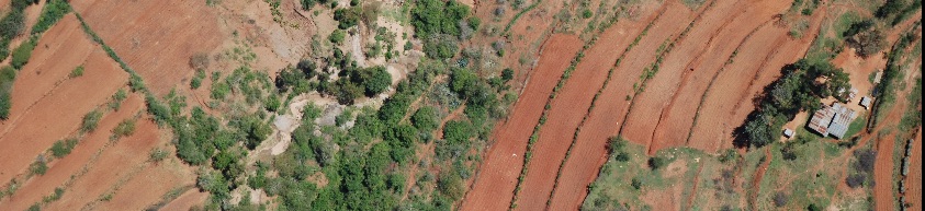
During the "Kenya Landuse Change" project conducted by the Climate Change Unit at ICRAF, several thousand aerial images were collected from surveys done in 1983 and 2012, respectively. During the last three months, the ICRAF GeoScience Lab has georeferenced this image archive to an accuracy of ~5m or better, with the help of six interns ...
Second seminar of "R seminar series" was held in ICRAF, Anthony Ndungu (andungu@cgiar.org) from Research Method Group (RMG) presented "Introduction to R". He also demonstrated RStudio Integrated Development Environment (IDE) and few examples.
The ICRAF GeoScience Lab and Research Methods Group are launching a weekly brown-bag seminar series at ICRAF. The two main objectives of the seminars are to:
- establish a R community of practice at ICRAF
- stimulate sharing of experiences and knowledge
- stimulate reproducible research
This space (http://landscapeportal.org/blog/categories/R) will be used to ...
Landscapeportal added to the Geonode gallery and mentioned at FOSS4G2014
Written by on Nov. 5, 2014 .
Last update on Nov. 5, 2014.
The landscapeportal, World Agroforestry Centre (ICRAF) website dedicated to sharing, visualization and in the future processing of spatial information, uniquely generated by ICRAF, was officially added to the Geonode gallery as a show case of organizations that uses Geonode, and open source Django web framework, that is used to create sites for sharing and distributing ...
Landscape portal at annual CGIAR-CSI meeting, Enschede
Written by on Oct. 14, 2014 in Workshop.
Last update on Oct. 28, 2014.
The ICRAF GeoScience Lab (GSL) recently participated in the CGIAR CSI meeting in Enschede, the Netherlands. During
this meeting, the Landscapes Portal was presented (presentation link)
along with some of its salient features (e.g time series tools, blog module etc.).
CGIAR is in the process of finalizing its Open Data policy and soon all ...
After six months (of inauguration, version 3), our data portal is growing day by day. About two months back we created an extent map of all the data sets in our portal (see below).
This time we decided to create a video. It shows the extent of all the data sets in landscape portal.
Cool ...
Explore data from our network of LDSF sites in the Sentinel Landscapes
Written by on Aug. 5, 2014 in Biodiversity, Land Degradation, Deforestation, Soil Mapping.
Last update on Aug. 5, 2014.
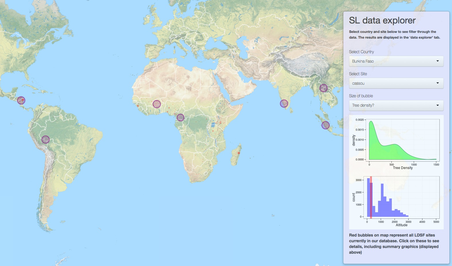
We are in the process of developing an interactive online mapping and analytical platform, and have just released a test version for the Sentinel Landscapes initiative. Click here to run the application in a new window in your browser. You can also view the sites on the Landscapes Portal here.